places in Thimphu
Bhutan
Thimphu
Thimphu
Administrative Region:
Thimphu District
population:
114 551
calling code:
+975-2
postcode:
11001
Location on the map of Bhutan
Thimphu
Fire station

Thimphu Fire Brigade
Thimphu
Fire station
read more
RBP Fire Division
Thimphu
Fire station
read more
Fire Services Division
Thimphu
Fire station
read more
Premise
Tamdin Ney Guru Temple
Thimphu
Premise
read more
Thimphu Handicraft Market
Thimphu
Premise
read more
RBA Helipad
Thimphu
Premise
read more
Bhutan Narcotic Control Agency
Thimphu
Premise
read more
Thimphu Primary School
Thimphu
Premise
read more
Lungtenzampa Middle Secondary School
Thimphu
Premise
read more
Department of Information Technology and Telecommunications
Thimphu
Premise
read more
Changzamtog Middle Secondary School
Thimphu
Premise
read more
Tenwang Complex
Thimphu
Premise
read more
Airport
Helipad
Thimphu
Airport
read more
Lungtenphug Helipad
Lungtenphug, Thimphu
Airport
read more
Doctor
Dechenchoeling Rinpoche Zimchung
Thimphu
Doctor
read more
Bhutan Centre for Advanced Dentistry (AdvaDent)
Thimphu
Doctor
read more
AdvaDent
Thimphu
Doctor
read more
Post office
Post Office
FJPP+944
Post office
Finance
Point of interest
Establishment
read more
Central Post Office, Thimpu, Bhutan
FJFQ+4P7, Thimphu
Post office
Finance
Point of interest
Establishment
read more
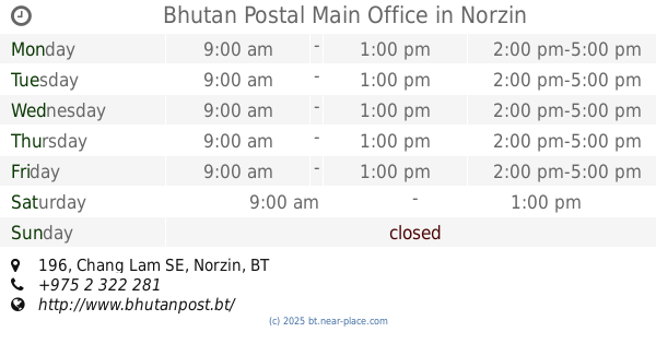
Bhutan Postal Main Office
196 Chang Lam SE, Norzin
Post office
Finance
Point of interest
Establishment
read more
📑
Thimphu all categories
Accounting
Administrative area level 1
Airport
Art gallery
Atm
Bakery
Bank
Bar
Beauty salon
Book store
Bus station
Cafe
Car dealer
Car rental
Car repair
Car wash
Cemetery
Church
City hall
Clothing store
Convenience store
Courthouse
Dentist
Doctor
Electronics store
Embassy
Establishment
Finance
Fire station
Food
Furniture store
Gas station
General contractor
Grocery or supermarket
Gym
Hair care
Hardware store
Health
Home goods store
Hospital
Insurance agency
Intersection
Jewelry store
Laundry
Lawyer
Library
Liquor store
Local government office
Locality
Lodging
Meal takeaway
Mosque
Movie theater
Museum
Neighborhood
Night club
Park
Parking
Pet store
Pharmacy
Place of worship
Point of interest
Police
Post office
Premise
Real estate agency
Restaurant
Route
School
Shoe store
Shopping mall
Spa
Stadium
Store
Supermarket
Taxi stand
Travel agency
University
Veterinary care
sublocality level 1
↑