
no info
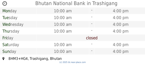
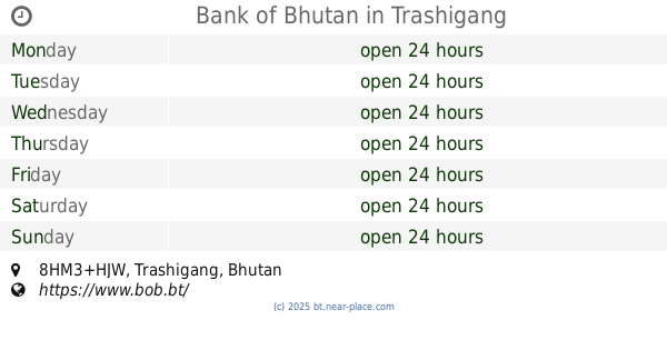
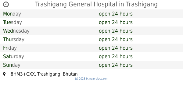
🕗 opening times
| Monday | ⚠ | |||||
| Tuesday | ⚠ | |||||
| Wednesday | ⚠ | |||||
| Thursday | ⚠ | |||||
| Friday | ⚠ | |||||
| Saturday | ⚠ | |||||
| Sunday | ⚠ | |||||
Samdrupjongkhar-Trashigang Highway, Trashigang, BT Bután
contacts phone: +975
website: www.trashigang.gov.bt
larger map & directionsLatitude: 27.3368915, Longitude: 91.5514621


Ugyen Wangchuck
::Love this place friendly Society
何庭溱
::泰國曼谷機場
Tashi Dendup
::It is a beautiful nestled on a peak atop just below the town. PS: Info provided by Sudarshana Kasabe in one of the reviews is completely wrong and I have reported it.
nitin singh
::Very nice building.
sudarshana kasabe
::Tadhigang dzong is an administrative dzong under Lhasa monastery or Dalai Lama . The dzong has monastery constructed in 1659 by the Abbott of the dzong. It is situated in drangme river valley and gamri Chu ( small river). The tashigang dzong is located on a picturesque ledge over 3 steep cliffs offering natural protection to the fortress. At an altitude of approximately 6000 ' above sea level it offers pleasant weather through out the year. The Indian soldiers used this access during their withdraw al from zimithang during sino Indian war of 1962.